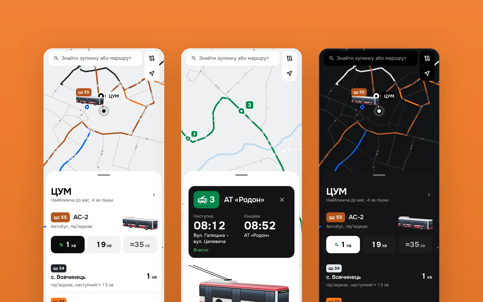
The stop you are walking to, answered first.
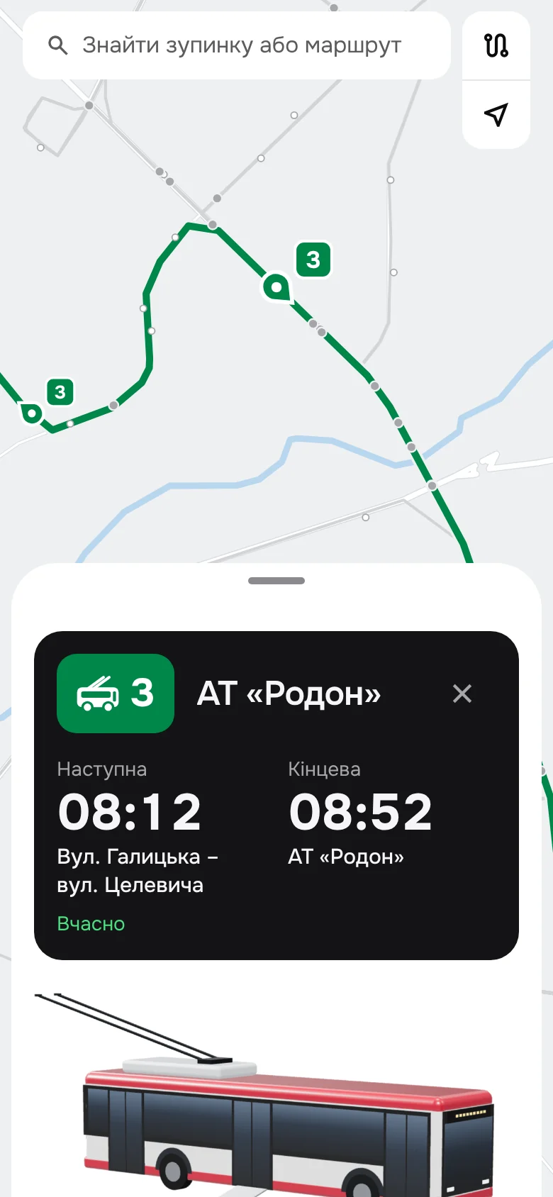
A redesign of Dozor, the transport app Ivano-Frankivsk uses, for someone already on the way to the stop. It opens on the nearest stop and its next arrival: the trolleybus or bus itself, where it goes, and its next three times side by side, the soonest on a black tile. Search sits on the map, so nothing comes before the answer.
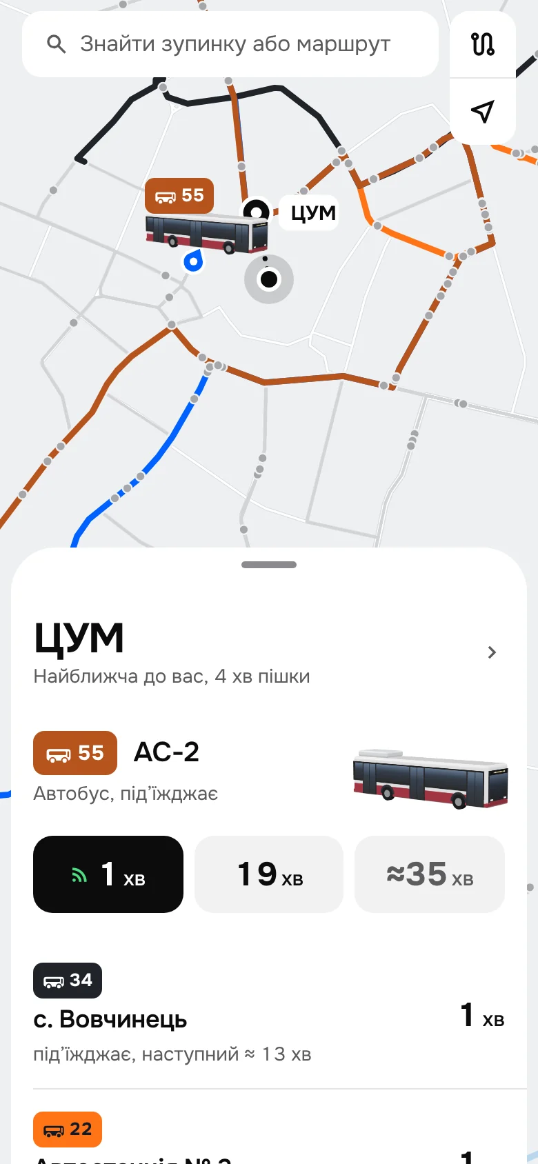
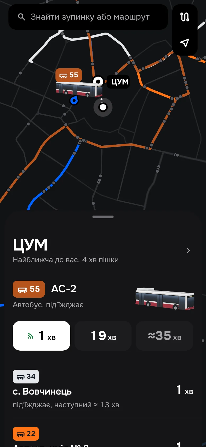
The map shows what the list says.
In the shipping app vehicle labels, places and route lines share one layer and one weight. Here the network is one quiet grey: only the lines of the arrivals in the list keep their colour, and only their vehicles heading this way carry numbers. Choose a stop, a line or a vehicle and the map glides to it while the sheet becomes its card.
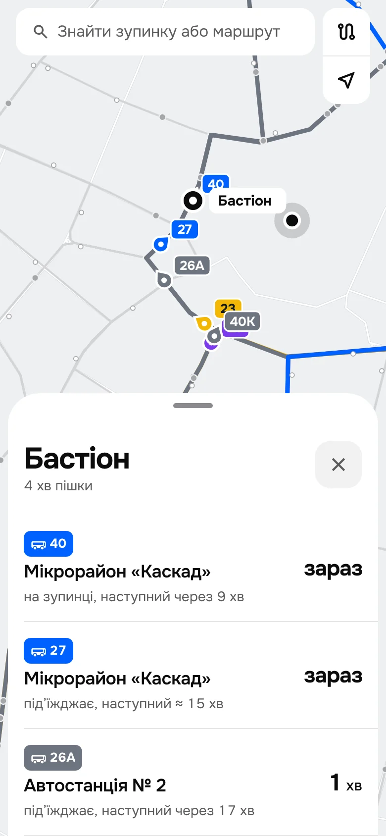
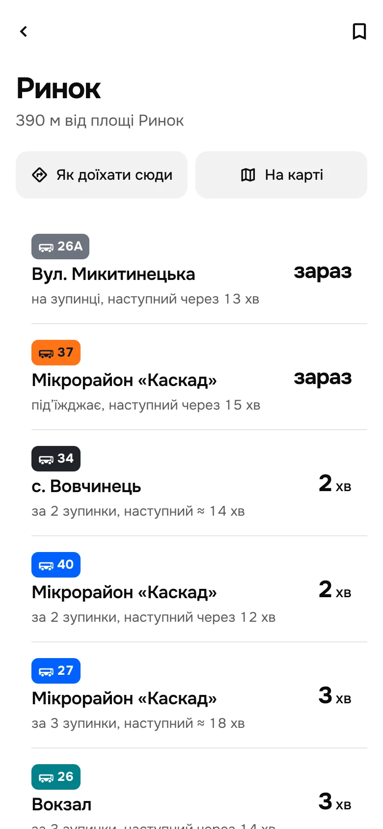
Every arrival has a direction.
In the shipping app a stop is a table of route numbers and minutes that doesn’t say which way each route goes. Here each row is one route in one direction: the route tag, where it goes, one line on where the vehicle is and when the next one comes, and the minutes on the right. The tag is the row’s only colour; lateness is said in words, and a time from the timetable carries ≈.
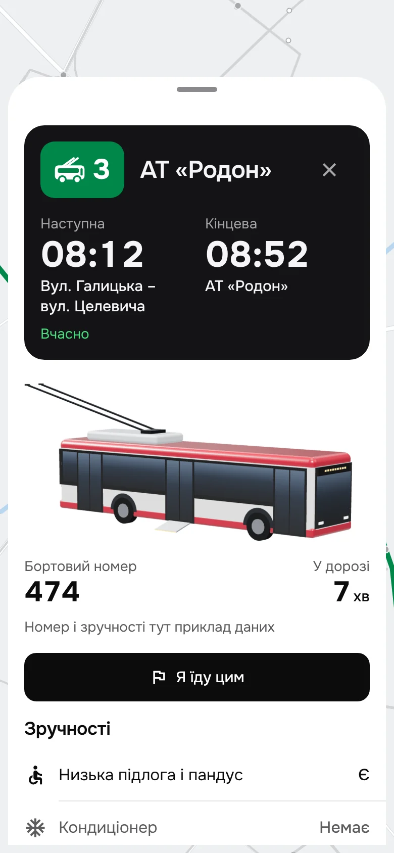
The vehicle you are about to board.
Ivano-Frankivsk’s Electron trolleybuses and its white-and-maroon city buses, modelled in 3D for this project after photos of the fleet. Each is rendered in layers, so it shows only what it has: air conditioning on the roof, a ramp at the middle door, a bike on the front rack. Beside it, the number on its side to check at the stop, and how long it has been on its way. That data is a labelled sample; a real feed would come from the operator.
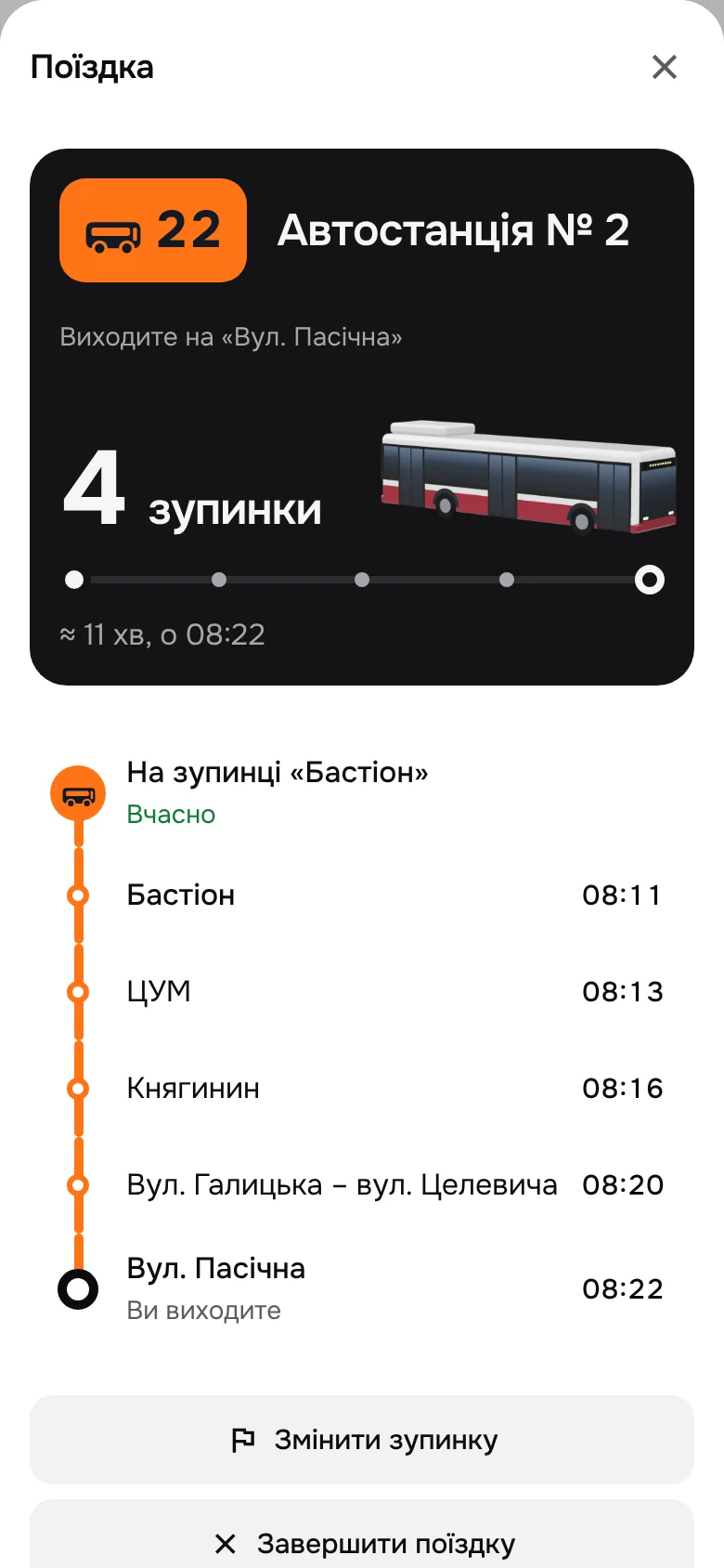
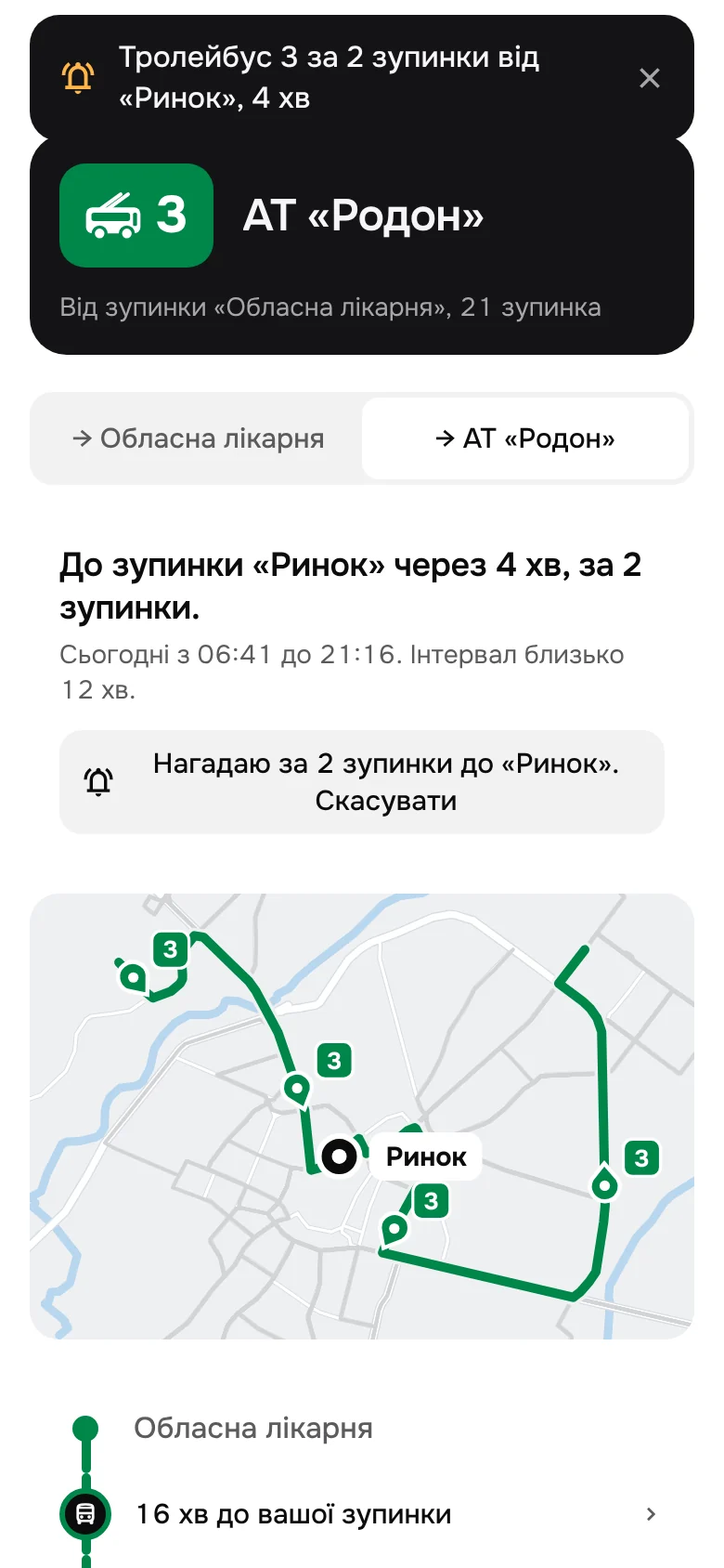
Ride it, and get off on time.
«Я їду цим» turns a vehicle into your ride. Pick your stop and the board counts the stops down, draws the ride as one line, stays on the home screen and says when the next stop is yours. A reminder can also wait for a vehicle until it is two stops away.
When the city changes.
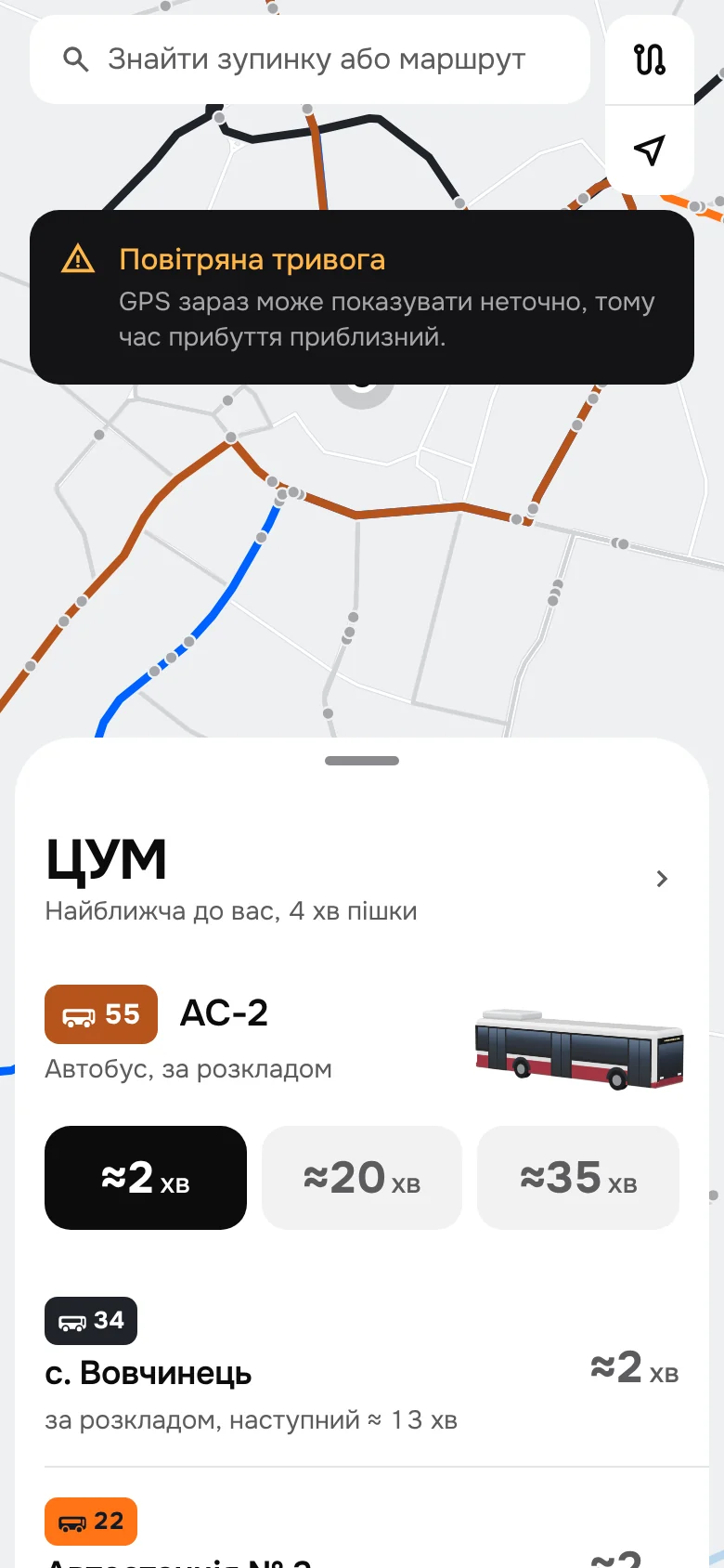
During an air alert GPS positions can’t be trusted, so every time becomes an estimate and a notice says why. If the trolleybuses stop, they leave the map, and each stop names the buses that go the same way.
Onest, and the city’s own colours.
Onest for every word and number, in Ukrainian. Route colours come from the city’s route list, set bright, and every tag carries a trolleybus or bus glyph, so the mode reads without colour. The arrivals mix what current transit apps do well, Moscow Transport, TfL Go and Ruter among them, on one white surface. A working Expo prototype in light and dark, checked at 160% text and on a 375 × 667 screen.
Not affiliated with or endorsed by DOZOR UKRAINA. Routes and stops are OpenStreetMap data checked against the city’s route list on data.gov.ua; vehicle positions, times, fleet numbers and amenities are simulated, and the vehicles are simplified models after photos of the city’s fleet. Source for the shipping app: the DozoR City listing on the App Store, version 2.22.3.